
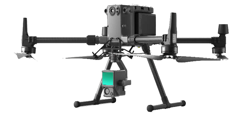
Zenmuse L1 LiDAR
FAA Certified Remote Pilot
UAS/UAV Onboard Anti-collision Sensors
“Fly-Away” Onboard Homing Device
1 HOUR OR LESS FLIGHT TIME FOR LARGE PROPERTIES
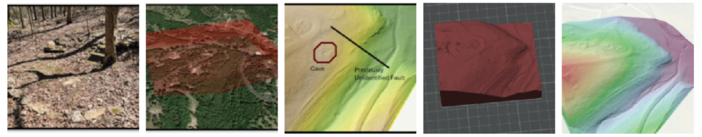
Environmental Works, Inc. is proud to partner with Missouri State University to offer single-day sinkhole and cave identification services. Using state-of-the-art LiDAR technology, we’re able to offer detailed topography models, assessments, and imaging of a variety of property types in just an hour or less. Whether you’re developing a commercial property or representing a client, we have the technology, knowledge, and team to get your project off on the right foot!
LiDAR Drone Services
- Rapid Property Assessments
- Hazard Assessments
- Landslides
- Slumping/Erosion
- Sinkholes
- Caves
- Detailed Topography Imaging and Modeling
- Layered Imaging
- Digital 3-D Modeling
- Physical 3-D Modeling
- Identification of Foreign Objects
- Identification of Disturbed Soil
- Assess Land Cover Change Over Time
Request a Quote
Need a quote on a specific project? Fill out our quick and easy quote form.